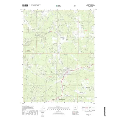
2019 Map of Conifer
USGS Topo · Published 2019About this map
Evergreen Mountain and the high ridges of the Arapaho National Forest dominate this landscape in Jefferson County. The map shows the suburban mountain character of the area around Conifer and Aspen Park, where winding residential drives like Shadow Mountain Drive and Stagecoach Road navigate steep topography. This 2019 survey documents a network of recreation trails, including the Evergreen Mountain West Trail and Lodgepole Loop, weaving through the timbered slopes. Notable local landmarks include the Marshdale Airport and several historic burial grounds such as Evergreen Memorial Park Cemetery and Pleasant Park Cemetery. The presence of Old US Highway 285 and named subdivisions like Broken Arrow Acres and Green Valley Acres illustrates the modern development pattern of these foothills communities, while drainage systems like Kennedy Gulch and North Turkey Creek define the primary natural corridors.
Find a feature on this map
54 named features on this map. Tap any name to fly to it.
Don’t see what you’re looking for? This feature index may not catch every label — zoom into the map to look around manually.
Map Details
Editions of this 2019 Conifer Map
This is the sole edition of this map. No revisions or reprints were ever made.
Other maps of this area

1893 · Platte Canyon
USGS Topo · 1:125,000

1899 · West Denver
USGS Topo · 1:125,000

1938 · Morrison
USGS Topo · 1:24,000

1942 · Morrison
USGS Topo · 1:31,680

1945 · Indian Hills
USGS Topo · 1:31,680

1945 · Platte Canyon
USGS Topo · 1:24,000

1945 · Pine
USGS Topo · 1:24,000

1945 · Bailey
USGS Topo · 1:24,000
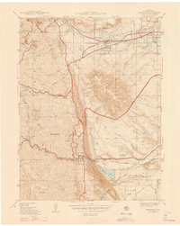
1947 · Morrison
USGS Topo · 1:31,680

1948 · Pine
USGS Topo · 1:24,000