
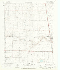
1965 Map of Conlen
USGS Topo · Published 1966About this map
Conlen serves as the primary focal point of this High Plains landscape in the mid-1960s, situated at the intersection of local roads and the Chicago Rock Island and Pacific railroad line. The settlement's agricultural foundation is clearly marked by a Grain Elevator alongside the tracks, a vital link for the region's grain economy. The surrounding terrain is defined by a vast network of water wells and scattered depressions, highlighting the intensive reliance on groundwater in this part of the Panhandle.
Find a feature on this map
9 named features on this map. Tap any name to fly to it.
Don’t see what you’re looking for? This feature index may not catch every label — zoom into the map to look around manually.
Map Details
Editions of this 1965 Conlen Map
This is the sole edition of this map. No revisions or reprints were ever made.
Other maps of this area

1954 · Dalhart
USGS Topo · 1:250,000

1958 · Dalhart
USGS Topo · 1:250,000

1962 · Dalhart
USGS Topo · 1:250,000

1964 · Brickel
USGS Topo · 1:24,000

1964 · Stratford 2 SE
USGS Topo · 1:24,000

1964 · Stratford
USGS Topo · 1:24,000

1965 · Wilco
USGS Topo · 1:24,000

1965 · Lautz
USGS Topo · 1:24,000
1965 · Cactus West
USGS Topo · 1:24,000

1965 · Wilco NE
USGS Topo · 1:24,000