
1964 Map of Stratford 2 SE
USGS Topo · Published 1966About this map
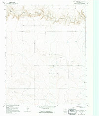
Coldwater Creek carves a deep, winding path through the northern high plains of the Texas Panhandle, defining the landscape of this 1960s survey. This portion of Dallam County is characterized by its wide plateaus and the intricate drainage network feeding into the creek valley. The map reveals the vital importance of water management in this arid cattle-and-wheat country, as seen in the numerous Wells and a specific Cistern dotted across the sections. These infrastructure points, along with a solitary Drill Hole, suggest the ongoing search for and extraction of resources from the Ogallala Aquifer and the depths below the caprock. The lack of towns or railroads emphasizes the expansive, agricultural nature of the region during the mid-century period.
Find a feature on this map
5 named features on this map. Tap any name to fly to it.
Don’t see what you’re looking for? This feature index may not catch every label — zoom into the map to look around manually.
Map Details
Editions of this 1964 Stratford 2 SE Map
2 editions found
Other maps of this area

1954 · Dalhart
USGS Topo · 1:250,000

1958 · Dalhart
USGS Topo · 1:250,000

1962 · Dalhart
USGS Topo · 1:250,000

1964 · Brickel
USGS Topo · 1:24,000

1964 · Kerrick
USGS Topo · 1:24,000

1964 · Stratford 2 NE
USGS Topo · 1:24,000

1965 · Conlen
USGS Topo · 1:24,000

1965 · Wilco NE
USGS Topo · 1:24,000

1973 · Stratford 2 NW
USGS Topo · 1:24,000
1973 · Chamberlin
USGS Topo · 1:24,000