
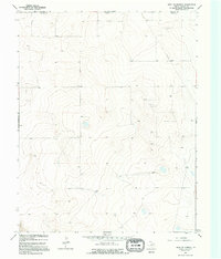
1964 Map of Stratford 2 NE
USGS Topo · Published 1966About this map
The high plains along the border between Oklahoma and Texas reflect a landscape defined by utility and energy extraction in the mid-1960s. Surveyed by the Texas Water Development Board, this terrain in Dallam County is marked by a sparse but deliberate network of agricultural and industrial infrastructure. A prominent Pipeline cuts across the northeastern quadrant, serviced by a nearby Substation, indicating the regional importance of natural gas transit during this era. Scattered Gas Well sites and local Wells dot the undulating contours, while isolated Storage Bins suggest the continued reliance on grain and livestock ranching. The lack of formal town centers highlights the rural, decentralized nature of the Panhandle at this time, where property lines and service roads provide the primary structural framework.
Find a feature on this map
7 named features on this map. Tap any name to fly to it.
Don’t see what you’re looking for? This feature index may not catch every label — zoom into the map to look around manually.
Map Details
Editions of this 1964 Stratford 2 NE Map
2 editions found
Other maps of this area

1954 · Dalhart
USGS Topo · 1:250,000

1958 · Dalhart
USGS Topo · 1:250,000

1962 · Dalhart
USGS Topo · 1:250,000

1964 · Brickel
USGS Topo · 1:24,000

1964 · Kerrick
USGS Topo · 1:24,000

1964 · Stratford 2 SE
USGS Topo · 1:24,000

1971 · Griggs SW
USGS Topo · 1:24,000

1971 · Conrad SW
USGS Topo · 1:24,000
1971 · Conrad
USGS Topo · 1:24,000

1973 · Stratford 2 NW
USGS Topo · 1:24,000