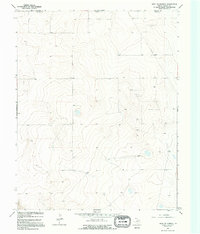
1964 Map of West of Kerrick
USGS Topo · Published 1995About this map
The borderlands of the Texas Panhandle and the Oklahoma state line characterize this 1960s landscape in Dallam County. The terrain is defined by wide agricultural expanses and the infrastructure of the energy industry, as indicated by a prominent Pipeline and a central substation. This survey, compiled from 1962 aerial photography and 1964 ground work, reveals a rural economy shifting toward industrial resource extraction, with several Gas Wells and clusters of storage bins scattered across the plains. Fine red dashed lines marking fence lines provide a rare level of detail for land-use historians and researchers tracking property boundaries in this sparsely populated region of the High Plains.
Find a feature on this map
6 named features on this map. Tap any name to fly to it.
Don’t see what you’re looking for? This feature index may not catch every label — zoom into the map to look around manually.
Map Details
Editions of this 1964 West of Kerrick Map
2 editions found
Other maps of this area

1954 · Dalhart
USGS Topo · 1:250,000

1958 · Dalhart
USGS Topo · 1:250,000

1962 · Dalhart
USGS Topo · 1:250,000

1964 · Brickel
USGS Topo · 1:24,000

1964 · Kerrick
USGS Topo · 1:24,000

1964 · Stratford 2 SE
USGS Topo · 1:24,000

1964 · Stratford 2 NE
USGS Topo · 1:24,000

1971 · Griggs SW
USGS Topo · 1:24,000

1971 · Conrad SW
USGS Topo · 1:24,000
1971 · Conrad
USGS Topo · 1:24,000