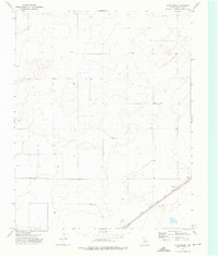
1973 Map of Chamberlin
USGS Topo · Published 1976About this map
Chamberlin sits as a small rail-side community in the high plains of the Texas Panhandle, defined by its position along the Chicago Rock Island and Pacific railroad. The landscape is dominated by subtle topographic contours and the essential infrastructure of water management, evidenced by numerous dispersed sites such as Well 4010 and Well 4003. These features suggest a region focused on livestock or agriculture where groundwater was the primary lifeline for both the residents and the steam-era rail operations that preceded this 1970s survey. Near the southeast corner of the map, a Roadside Park and a Gravel Pit indicate the intersection of transportation and local industry, providing a window into the functional character of Dallam County during this period.
Find a feature on this map
8 named features on this map. Tap any name to fly to it.
Don’t see what you’re looking for? This feature index may not catch every label — zoom into the map to look around manually.
Map Details
Editions of this 1973 Chamberlin Map
This is the sole edition of this map. No revisions or reprints were ever made.
Other maps of this area

1954 · Dalhart
USGS Topo · 1:250,000

1958 · Dalhart
USGS Topo · 1:250,000

1962 · Dalhart
USGS Topo · 1:250,000

1964 · Stratford 2 SE
USGS Topo · 1:24,000

1965 · Wilco
USGS Topo · 1:24,000

1965 · Wilco NE
USGS Topo · 1:24,000

1973 · Bolin NE
USGS Topo · 1:24,000
1973 · Pritchard Ranch
USGS Topo · 1:24,000
1973 · Dalhart East
USGS Topo · 1:24,000
1973 · Dalhart West
USGS Topo · 1:24,000