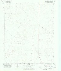
1973 Map of Pritchard Ranch
USGS Topo · Published 1976About this map
Pritchard Ranch serves as the central landmark in this high plains landscape of Dallam County during the early 1970s. The terrain is defined by wide drainage patterns and scattered resource extraction, with the prominent Red Cow Draw cutting across the northeastern quadrant. Local operations are marked by a series of labels including Nickel, Dime, and several Gravel Pit locations, suggesting a network of small-scale mining or material gathering integrated into the ranching environment. Evidence of water management and exploration is visible through various Well sites and a specific Drill Hole, reflecting the practical necessities of life in the Texas Panhandle. This survey captures a moment when the rural economy relied heavily on these isolated points of infrastructure scattered across the open range.
Find a feature on this map
8 named features on this map. Tap any name to fly to it.
Don’t see what you’re looking for? This feature index may not catch every label — zoom into the map to look around manually.
Map Details
Editions of this 1973 Pritchard Ranch Map
This is the sole edition of this map. No revisions or reprints were ever made.
Other maps of this area

1954 · Dalhart
USGS Topo · 1:250,000

1958 · Dalhart
USGS Topo · 1:250,000

1962 · Dalhart
USGS Topo · 1:250,000

1973 · Stratford 2 NW
USGS Topo · 1:24,000

1973 · Tovrea Ranch
USGS Topo · 1:24,000

1973 · Bolin NE
USGS Topo · 1:24,000

1973 · Bolin
USGS Topo · 1:24,000
1973 · Coldwater West
USGS Topo · 1:24,000

1973 · Coldwater East
USGS Topo · 1:24,000
1973 · Chamberlin
USGS Topo · 1:24,000