
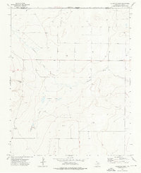
1973 Map of Tovrea Ranch
USGS Topo · Published 1975About this map
Tovrea Ranch serves as a primary landmark in this high plains landscape of Dallam County, situated amidst the subtle drainage patterns of the Texas Panhandle. The topography is defined by the winding course of Rito Blanca Creek, which cuts through the undulating terrain in the southwestern portion of the map. This 1970s survey captures a rural environment where land use is dominated by large-scale ranching operations and industrial infrastructure, evidenced by the prominent Pipeline corridor that traverses the northern sections. The scarcity of named settlements highlights the isolated nature of these ranching outposts, where survival depended on the seasonal flows of local creek beds and the management of extensive open range.
Find a feature on this map
3 named features on this map. Tap any name to fly to it.
Don’t see what you’re looking for? This feature index may not catch every label — zoom into the map to look around manually.
Map Details
Editions of this 1973 Tovrea Ranch Map
This is the sole edition of this map. No revisions or reprints were ever made.
Other maps of this area

1954 · Dalhart
USGS Topo · 1:250,000

1958 · Dalhart
USGS Topo · 1:250,000

1962 · Dalhart
USGS Topo · 1:250,000

1973 · Buffalo Springs
USGS Topo · 1:24,000

1973 · Wharton Ranch
USGS Topo · 1:24,000

1973 · Perico
USGS Topo · 1:24,000

1973 · Bolin NE
USGS Topo · 1:24,000

1973 · Bolin
USGS Topo · 1:24,000
1973 · Coldwater West
USGS Topo · 1:24,000

1973 · Coldwater East
USGS Topo · 1:24,000