
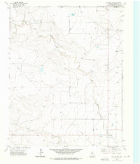
1973 Map of Buffalo Springs
USGS Topo · Published 1975About this map
Buffalo Springs and the surrounding High Plains terrain dominate this 1973 survey, capturing the landscape along the Oklahoma-Texas border. The map illustrates a high-desert environment where water sources like Coldwater Creek and Buffalo Springs were essential to early cattle ranching and settlement. Evidence of local habitation is concentrated at Thompson Grove, while the drainage patterns around the Alkali Lakes and Water Lake reflect the typical hydrologic cycles of the northern Texas Panhandle. Scattered wells and a Gravel Pit suggest a landscape geared toward rural utility and resource extraction. The proximity to the Cimarron and Dallam county line highlights the remote nature of this borderland area during the early 1970s, providing a clear record of the region's topography before more modern development or shifts in groundwater levels occurred.
Find a feature on this map
11 named features on this map. Tap any name to fly to it.
Don’t see what you’re looking for? This feature index may not catch every label — zoom into the map to look around manually.
Map Details
Editions of this 1973 Buffalo Springs Map
This is the sole edition of this map. No revisions or reprints were ever made.
Other maps of this area

1954 · Dalhart
USGS Topo · 1:250,000

1958 · Dalhart
USGS Topo · 1:250,000

1962 · Dalhart
USGS Topo · 1:250,000

1969 · Felt SW
USGS Topo · 1:24,000

1969 · Boise City SW
USGS Topo · 1:24,000

1969 · Felt
USGS Topo · 1:24,000

1973 · Tovrea Ranch
USGS Topo · 1:24,000

1973 · Corlena
USGS Topo · 1:24,000

1973 · Perico
USGS Topo · 1:24,000
1973 · Corlena NW
USGS Topo · 1:24,000