
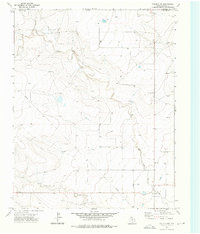
1973 Map of Corlena
USGS Topo · Published 1975About this map
Fort Worth and Denver tracks run diagonally across this portion of the Texas Panhandle, anchoring the small settlements of Corlena and Perico. The landscape is defined by the drainage of Rita Blanca Creek and its tributary, East Rita Blanca Cr, which cut through the high plains topography in the northern section of the quadrangle. Outside of the rail corridor, the area is largely characterized by a network of unimproved roads and scattered water wells, reflecting the rural ranching and agricultural nature of Dallam County in the early 1970s. Key local landmarks include St Marys Church near the southern edge and a Roadside Park located along the primary highway, providing essential community and traveler waypoints in a sparsely populated environment.
Find a feature on this map
9 named features on this map. Tap any name to fly to it.
Don’t see what you’re looking for? This feature index may not catch every label — zoom into the map to look around manually.
Map Details
Editions of this 1973 Corlena Map
This is the sole edition of this map. No revisions or reprints were ever made.
Other maps of this area

1954 · Dalhart
USGS Topo · 1:250,000

1958 · Dalhart
USGS Topo · 1:250,000

1962 · Dalhart
USGS Topo · 1:250,000

1970 · Texline South
USGS Topo · 1:24,000

1970 · Texline North
USGS Topo · 1:24,000

1970 · Sedan NE
USGS Topo · 1:24,000

1973 · Buffalo Springs
USGS Topo · 1:24,000

1973 · Wharton Ranch
USGS Topo · 1:24,000

1973 · Perico
USGS Topo · 1:24,000
1973 · Corlena NW
USGS Topo · 1:24,000