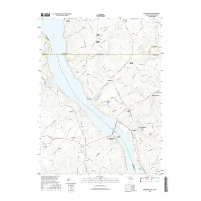
2016 Map of Conowingo Dam
USGS Topo · Published 2016About this map
The Susquehanna River dominates this landscape along the Maryland and Pennsylvania border, where engineering and history converge at the Conowingo Dam. The massive Susquehanna River Reservoir spans the western portion of the map, flanked by significant landmarks such as Wildcat Point and Cromleys Mtn. The river’s industrial and social heritage is evident in the presence of the Old Conowingo Iron Bridge and the cluster of settlements like Conowingo Village and Rowlandsville.
Find a feature on this map
154 named features on this map. Tap any name to fly to it.
Don’t see what you’re looking for? This feature index may not catch every label — zoom into the map to look around manually.
Map Details
Editions of this 2016 Conowingo Dam Map
This is the sole edition of this map. No revisions or reprints were ever made.
Other maps of this area

1900 · Havre De Grace
USGS Topo · 1:62,500

1901 · Belair
USGS Topo · 1:62,500

1912 · Quarryville
USGS Topo · 1:62,500

1912 · Mc Calls Ferry
USGS Topo · 1:62,500

1942 · Havre De Grace
USGS Topo · 1:62,500

1942 · Bel Air
USGS Topo · 1:62,500

1943 · Quarryville
USGS Topo · 1:62,500

1943 · Mc Calls Ferry
USGS Topo · 1:62,500

1945 · Bel Air
USGS Topo · 1:62,500

1948 · Baltimore
USGS Topo · 1:250,000