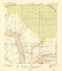
1946 Map of Convent
USGS Topo · Published 1946About this map
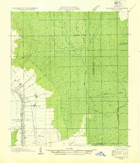
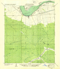
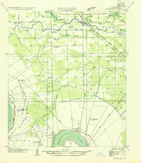
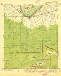
St Josephs Plantation and the iconic Oak Alley Plantation line the southern banks of the Mississippi River, reflecting the deeply established agricultural and residential patterns of St. James Parish. This 1935 field examination reveals a landscape organized by narrow riverfront land grants, stretching back from the river toward the Blind River swamps. The settlement at Convent serves as a focal point, supported by the Illinois Central Railroad and the proximity of Convent Sta. Local spiritual life is anchored by St James Ch and Mt Olive Ch, while landmarks like Nita Crevasse hint at the historical hydraulic forces of the river. The presence of multiple rail lines, including the Texas and Pacific Railroad, underscores the area's importance as a transportation corridor between New Orleans and Baton Rouge during the mid-1940s.
Find a feature on this map
39 named features on this map. Tap any name to fly to it.
Don’t see what you’re looking for? This feature index may not catch every label — zoom into the map to look around manually.
Map Details
Editions of this 1946 Convent Map
This is the sole edition of this map. No revisions or reprints were ever made.
Other maps of this area

1892 · Lac Des Allemands
USGS Topo · 1:62,500

1892 · Mount Airy
USGS Topo · 1:62,500

1892 · Donaldsonville
USGS Topo · 1:62,500

1892 · Thibodaux
USGS Topo · 1:62,500
1927 · Thibodaux NW
USGS Topo · 1:31,680

1932 · Lac Des Allemands NW
USGS Topo · 1:31,680
1932 · Thibodaux NE
USGS Topo · 1:31,680
1935 · Gonzales
USGS Topo · 1:31,680

1939 · Donaldsonville
USGS Topo · 1:62,500
1940 · Lagan
USGS Topo · 1:31,680