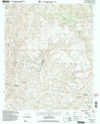
2004 Map of Cooks Mesa
USGS Topo · Published 2006About this map
Tonto National Forest land dominates this 2004 revision of the Cooks Mesa quadrangle, a terrain of complex drainage networks and remote water sources. The landscape is defined by its canyons and springs, from the northern reaches of Squaw Creek and Six Bar Hole down to the southern depths of Sycamore Canyon. This map preserves the locations of vital desert resources including Tin Trough Spring, Laurel Hole Spring, and Mormon Tank, which supported cattle ranching in an arid environment. The presence of Upper Ranch near the center of the sheet and various prospects suggests a history of localized land use and resource extraction. Significant elevation markers like Benchmark Mountain and Monument Mountain anchor the topography, while the Second Standard Parallel North provides a key surveying reference for the region bordering Yavapai and Maricopa counties.
Find a feature on this map
86 named features on this map. Tap any name to fly to it.
Don’t see what you’re looking for? This feature index may not catch every label — zoom into the map to look around manually.
Map Details
Editions of this 2004 Cooks Mesa Map
This is the sole edition of this map. No revisions or reprints were ever made.
Other maps of this area

1887 · Verde
USGS Topo · 1:250,000

1887 · Prescott
USGS Topo · 1:250,000

1892 · Verde
USGS Topo · 1:250,000

1892 · Prescott
USGS Topo · 1:250,000

1903 · Bradshaw Mountains
USGS Topo · 1:125,000

1929 · Turret Peak
USGS Topo · 1:125,000

1930 · Cave Creek
USGS Topo · 1:125,000

1933 · Turret Peak
USGS Topo · 1:125,000

1939 · Cave Creek
USGS Topo · 1:125,000

1947 · Bumblebee
USGS Topo · 1:62,500