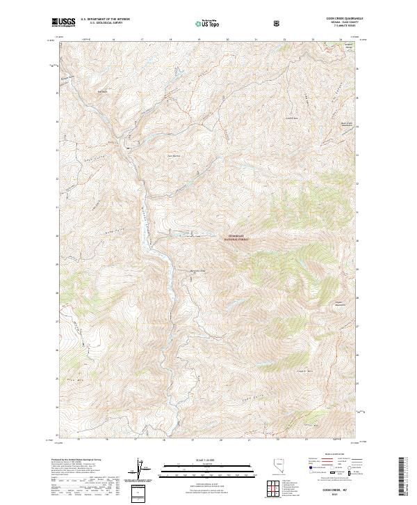
2021 Map of Coon Creek
USGS Topo · Published 2021About this map
Humboldt National Forest lands dominate this high-desert landscape in Elko County, where the topography is defined by the deep incision of Bruneau Canyon. The northern reaches of the Copper Mountains and the Buck Creek Mountains meet here, creating a complex series of ridges and draws. Water is the primary sculptor of the terrain, from the Bruneau River to seasonal drainages like Marcellini Draw and Murphy Wash. This survey documents a vast network of wilderness access points, including the Wickiuip Trl and Copper Mountain Trl, which navigate the steep elevations between Granite Mtn and Silver Mtn. The lack of permanent settlements emphasizes the region's character as a managed natural resource area, focusing instead on named landmarks such as Twin-Buttes and the Ichabod Range.
Find a feature on this map
56 named features on this map. Tap any name to fly to it.
Don’t see what you’re looking for? This feature index may not catch every label — zoom into the map to look around manually.
Map Details
Editions of this 2021 Coon Creek Map
This is the sole edition of this map. No revisions or reprints were ever made.
Other maps of this area

1935 · Charleston
USGS Topo · 1:48,000

1936 · Rowland
USGS Topo · 1:48,000

1940 · Rowland
USGS Topo · 1:62,500

1942 · Mt. Velma
USGS Topo · 1:62,500

1943 · Jarbidge
USGS Topo · 1:62,500

1945 · Jarbidge
USGS Topo · 1:62,500

1955 · Wells
USGS Topo · 1:250,000

1958 · Wells
USGS Topo · 1:250,000

1961 · Wells
USGS Topo · 1:250,000
1968 · Marys River Basin NW
USGS Topo · 1:24,000