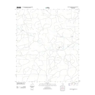
2012 Map of Coon Dive Draw NW
USGS Topo · Published 2012About this map
Edwards Cem provides a focal point for genealogical interest in this sparsely populated region of Sterling County. The landscape is primarily defined by the winding course of Sterling Cr, which dictates the placement of rural infrastructure across the West Texas terrain. This ranching-oriented layout is marked by functional landmarks such as Bull Pasture Windmill and Wilson Pasture Windmill, which signify the importance of water management in this arid environment. A network of local roads and cattle paths, including Old Big Lake Rd and Ranch Road 2139, connects the various pastures. The map details a quiet, working landscape where modern transport routes like Brownfield Rd overlay older patterns of land use and seasonal drainage.
Find a feature on this map
14 named features on this map. Tap any name to fly to it.
Don’t see what you’re looking for? This feature index may not catch every label — zoom into the map to look around manually.
Map Details
Editions of this 2012 Coon Dive Draw NW Map
This is the sole edition of this map. No revisions or reprints were ever made.
Other maps of this area

1954 · San Angelo
USGS Topo · 1:250,000

1958 · San Angelo
USGS Topo · 1:250,000

1963 · Cumbie Draw
USGS Topo · 1:24,000

1963 · Glass Ranch
USGS Topo · 1:24,000

1963 · Currie Reservoir
USGS Topo · 1:24,000

1965 · San Angelo
USGS Topo · 1:250,000

1973 · Hay Hollow
USGS Topo · 1:24,000

1973 · Three Bluff Draw
USGS Topo · 1:24,000
1973 · Coon Dive Draw
USGS Topo · 1:24,000

1973 · Three Bluff Draw NE
USGS Topo · 1:24,000