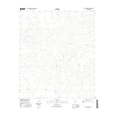
2016 Map of Coon Dive Draw NW
USGS Topo · Published 2016About this map
Edwards Cem sits on a small rise above the valley of Sterling Cr, serving as a quiet landmark in this ranching landscape of West Texas. The terrain is defined by the winding course of the creek and a series of branching draws that shape the local topography. A network of rural roads, including the long stretches of Old Big Lake Rd and Brownfield Rd, connects isolated parcels and provides access to the higher elevations flanking the waterway. This contemporary survey records the modern infrastructure of Sterling County, where state routes like FM 2139 intersect with numerous county roads like Co Rd 108-P, reflecting the ongoing agricultural and logistical importance of the region's interior.
Find a feature on this map
11 named features on this map. Tap any name to fly to it.
Don’t see what you’re looking for? This feature index may not catch every label — zoom into the map to look around manually.
Map Details
Editions of this 2016 Coon Dive Draw NW Map
This is the sole edition of this map. No revisions or reprints were ever made.
Other maps of this area

1954 · San Angelo
USGS Topo · 1:250,000

1958 · San Angelo
USGS Topo · 1:250,000

1963 · Cumbie Draw
USGS Topo · 1:24,000

1963 · Glass Ranch
USGS Topo · 1:24,000

1963 · Currie Reservoir
USGS Topo · 1:24,000

1965 · San Angelo
USGS Topo · 1:250,000

1973 · Hay Hollow
USGS Topo · 1:24,000

1973 · Three Bluff Draw
USGS Topo · 1:24,000
1973 · Coon Dive Draw
USGS Topo · 1:24,000

1973 · Three Bluff Draw NE
USGS Topo · 1:24,000