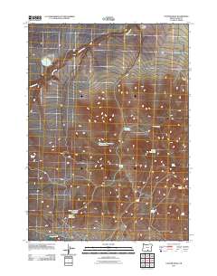
2011 Map of Cooper Draw
USGS Topo · Published 2011About this map
Fitzgerald Reservoir Number Two and General Reservoir serve as central landmarks in this high-desert landscape of Lake County, Oregon. The topography is defined by the ephemeral drainage systems of Rabbit Creek and Snyder Creek, which feed a series of remote water catchments and natural springs. These vital water sources, including Binkey Lake and Spring Reservoir, indicate a landscape managed for livestock or wildlife in an otherwise arid environment. The naming conventions found in Cooper Draw and Windy Hollow Draw suggest a history of localized ranching and homesteading, where every reliable water point was of paramount importance. The distribution of features like Forward Spring, Cement Spring, and Juniper Spring across the terrain reveals the sparse but essential network of groundwater locations that supported human and animal activity in this corner of the state during the early 21st century.
Find a feature on this map
18 named features on this map. Tap any name to fly to it.
Don’t see what you’re looking for? This feature index may not catch every label — zoom into the map to look around manually.
Map Details
Editions of this 2011 Cooper Draw Map
This is the sole edition of this map. No revisions or reprints were ever made.
Other maps of this area

1955 · Klamath Falls
USGS Topo · 1:250,000

1955 · Adel
USGS Topo · 1:250,000

1957 · Adel
USGS Topo · 1:250,000

1958 · Klamath Falls
USGS Topo · 1:250,000

1958 · Adel
USGS Topo · 1:250,000

1962 · Adel
USGS Topo · 1:250,000

1966 · Rabbit Hills NW
USGS Topo · 1:24,000

1967 · Plush
USGS Topo · 1:24,000

1967 · Rabbit Hills SW
USGS Topo · 1:24,000
1968 · Drake Peak NE
USGS Topo · 1:24,000