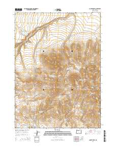
2014 Map of Cooper Draw
USGS Topo · Published 2014About this map
Snyder Rnch sits at the southern edge of this high-desert basin in Lake County, serving as a primary marker of human habitation in a landscape defined by seasonal water and drainages. The area is characterized by a complex network of springs and reservoirs, including Fitzgerald Reservoir Number Two, General Reservoir, and Upper Juniper Reservoir, which suggest the critical importance of water management for livestock and ranching. The terrain is shaped by several prominent draws, such as Mary Ann Draw, Miners Draw, and Cooper Draw, which cut through the Coyote Hills. Dozens of named springs, such as Cement Spg and Oregon Spg, are scattered across the quadrangle, highlighting the scattered reliable water sources that sustain the region's ranching economy. Significant drainage systems like Rabbit Cr and Snyder Crk further illustrate the hydrology of this arid corner of Oregon.
Find a feature on this map
36 named features on this map. Tap any name to fly to it.
Don’t see what you’re looking for? This feature index may not catch every label — zoom into the map to look around manually.
Map Details
Editions of this 2014 Cooper Draw Map
This is the sole edition of this map. No revisions or reprints were ever made.
Other maps of this area

1955 · Klamath Falls
USGS Topo · 1:250,000

1955 · Adel
USGS Topo · 1:250,000

1957 · Adel
USGS Topo · 1:250,000

1958 · Klamath Falls
USGS Topo · 1:250,000

1958 · Adel
USGS Topo · 1:250,000

1962 · Adel
USGS Topo · 1:250,000

1966 · Rabbit Hills NW
USGS Topo · 1:24,000

1967 · Plush
USGS Topo · 1:24,000

1967 · Rabbit Hills SW
USGS Topo · 1:24,000
1968 · Drake Peak NE
USGS Topo · 1:24,000