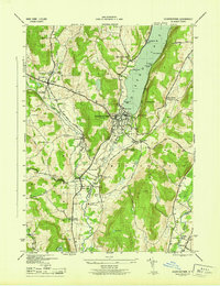
1945 Map of Cooperstown
USGS Topo · Published 1945About this map
Cooperstown serves as the hub of this mid-century survey, situated at the southern tip of Otsego Lake where the Susquehanna River begins its journey south. The landscape is defined by the steep ridges of Murphy Hill and Burke Hill, with the agricultural and industrial activity of the era concentrated along the river valleys and creek beds. Numerous small rural schools, such as School No 16 and School No 5, are scattered across the townships of Otsego and Middlefield, reflecting the traditional social organization of the New York countryside before centralized districts became the norm.
Find a feature on this map
58 named features on this map. Tap any name to fly to it.
Don’t see what you’re looking for? This feature index may not catch every label — zoom into the map to look around manually.
Map Details
Editions of this 1945 Cooperstown Map
This is the sole edition of this map. No revisions or reprints were ever made.
Other maps of this area

1903 · Richfield Springs
USGS Topo · 1:62,500

1907 · Winfield
USGS Topo · 1:62,500

1907 · Cooperstown
USGS Topo · 1:62,500

1909 · Cooperstown
USGS Topo · 1:62,500

1910 · Hartwick
USGS Topo · 1:62,500

1912 · Hartwick
USGS Topo · 1:62,500

1943 · Schuyler Lake
USGS Topo · 1:24,000

1943 · Mt Vision
USGS Topo · 1:24,000

1943 · Milford
USGS Topo · 1:24,000

1943 · Richfield Springs
USGS Topo · 1:24,000