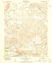
1953 Map of Cooperstown
USGS Topo · Published 1955About this map
Cooperstown stands as a rail-dependent hub along the Sierra Railroad in this mid-century survey of the Stanislaus and Tuolumne county border. The landscape is defined by the sophisticated water management systems of the San Joaquin Valley, including the Modesto Main Canal, Main Canal, and numerous irrigation laterals. To the south, the Tuolumne River corridor reveals the heavy industrial footprint of gold mining, with extensive Dredge Tailings lining the banks near Turlock Lake State Park. Small rural settlements like Warnersville and Rydberg are connected by local routes such as Barnett Road, while the Roberts Ferry School and Diamond S Ranch provide specific landmarks for genealogical research. The map illustrates a transitional period where traditional ranching and the remnants of industrial dredging coexist with modern reservoir-based recreation at Turlock Lake.
Find a feature on this map
25 named features on this map. Tap any name to fly to it.
Don’t see what you’re looking for? This feature index may not catch every label — zoom into the map to look around manually.
Map Details
Editions of this 1953 Cooperstown Map
This is the sole edition of this map. No revisions or reprints were ever made.
Other maps of this area

1893 · Sonora
USGS Topo · 1:125,000

1896 · Sonora
USGS Topo · 1:125,000

1897 · Sonora
USGS Topo · 1:125,000

1898 · Sonora
USGS Topo · 1:125,000

1913 · Dickenson
USGS Topo · 1:31,680

1915 · Paulsell
USGS Topo · 1:31,680

1915 · La Grange
USGS Topo · 1:24,000

1916 · Three Tree Flat
USGS Topo · 1:31,680

1916 · Montpellier
USGS Topo · 1:31,680

1916 · Cooperstown
USGS Topo · 1:31,680