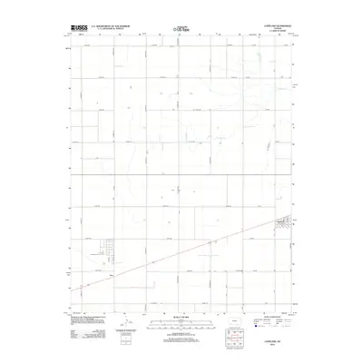
2012 Map of Copeland
USGS Topo · Published 2012About this map
Copeland serves as the primary hub in this corner of Gray County, defined by its rectilinear grid and the intersection of local routes. The town structure is anchored by Thatcher St and Moore St, with the central Po serving as a focal point for the surrounding agricultural community. Outside the town limits, the landscape transitions into a vast network of section-line roads, such as Co Rd-140 and Co Rd-160, which partition the Kansas plains into precise geometric blocks.
Find a feature on this map
30 named features on this map. Tap any name to fly to it.
Don’t see what you’re looking for? This feature index may not catch every label — zoom into the map to look around manually.
Map Details
Editions of this 2012 Copeland Map
This is the sole edition of this map. No revisions or reprints were ever made.
Other maps of this area

1896 · Garden
USGS Topo · 1:125,000

1955 · Dodge City
USGS Topo · 1:250,000

1958 · Dodge City
USGS Topo · 1:250,000

1959 · Dodge City
USGS Topo · 1:250,000

1959 · Garden City 3 NE
USGS Topo · 1:24,000

1960 · Garden City 3 SE
USGS Topo · 1:24,000

1967 · Plains NE
USGS Topo · 1:24,000

1968 · Plains NW
USGS Topo · 1:24,000
1968 · Sublette
USGS Topo · 1:24,000
1969 · Copeland SE
USGS Topo · 1:24,000