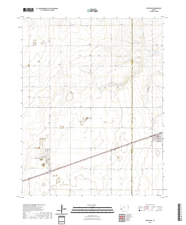
2022 Map of Copeland
USGS Topo · Published 2022About this map
The town of Copeland sits at the intersection of a vast grid of section roads and modern thoroughfares in this portion of Western Kansas. Located along the border of Haskell Co and Gray Co, the landscape is defined by the rectilinear precision of the Public Land Survey System, with roads like Co Rd 150 and Co Rd 160 cutting across the plains. In the northeast, the meandering path of Crooked Cr provides a sharp contrast to the geometric agricultural layout, carving a slight depression through the otherwise level terrain. The small community of Tice appears further west, connected by the same rail and road corridor that serves the region's agricultural economy. This 2022 survey documents the residential street plan of Copeland, including Mcbride St and Thatcher St, while showing the density of farmsteads and rural infrastructure that characterizes the modern High Plains.
Find a feature on this map
35 named features on this map. Tap any name to fly to it.
Don’t see what you’re looking for? This feature index may not catch every label — zoom into the map to look around manually.
Map Details
Editions of this 2022 Copeland Map
This is the sole edition of this map. No revisions or reprints were ever made.
Other maps of this area

1896 · Garden
USGS Topo · 1:125,000

1955 · Dodge City
USGS Topo · 1:250,000

1958 · Dodge City
USGS Topo · 1:250,000

1959 · Dodge City
USGS Topo · 1:250,000

1959 · Garden City 3 NE
USGS Topo · 1:24,000

1960 · Garden City 3 SE
USGS Topo · 1:24,000

1967 · Plains NE
USGS Topo · 1:24,000

1968 · Plains NW
USGS Topo · 1:24,000
1968 · Sublette
USGS Topo · 1:24,000
1969 · Copeland SE
USGS Topo · 1:24,000