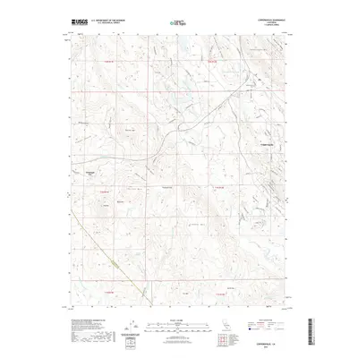
2021 Map of Copperopolis
USGS Topo · Published 2021About this map
Telegraph City and Copperopolis anchor this landscape in the foothills where the Calaveras Co and Stanislaus Co line meet. The area is defined by a series of named ridges and gulches that speak to its mineral and transit history, including Copperopolis Mtn, Boucher Mtn, and the distinctive Big Seven Ridge. Water systems are central to the terrain, with Littlejohns Cr and Rock Creek flowing through the valleys, while the Copperopolis Reservoir serves the namesake settlement to the northeast.
Find a feature on this map
87 named features on this map. Tap any name to fly to it.
Don’t see what you’re looking for? This feature index may not catch every label — zoom into the map to look around manually.
Map Details
Editions of this 2021 Copperopolis Map
This is the sole edition of this map. No revisions or reprints were ever made.
Other maps of this area

1889 · Jackson
USGS Topo · 1:125,000

1892 · Jackson
USGS Topo · 1:125,000

1897 · Jackson
USGS Topo · 1:125,000

1902 · Jackson
USGS Topo · 1:125,000

1915 · Oakdale
USGS Topo · 1:31,680

1916 · Bachelor Valley
USGS Topo · 1:31,680

1916 · Copperopolis
USGS Topo · 1:62,500

1942 · Farmington
USGS Topo · 1:62,500

1942 · Copperopolis
USGS Topo · 1:62,500

1944 · Valley Springs
USGS Topo · 1:62,500
Featured Places
- Telegraph City, CA
- Copper Cove Subdivision, CA
- Copper Cove Village, CA
- Copperopolis, CA
- Stanislaus County, CA