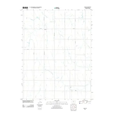
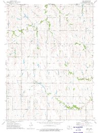
2012 Map of Cora
USGS Topo · Published 2012About this map
Cora and Womer stand as the primary anchors in this agricultural landscape of Smith County, surveyed in the early 21st century. The terrain is defined by a dendritic network of seasonal and perennial waterways, including Pawnee Cr and White Rock Cr, which carve through the plains. Local history is preserved at the Cedar Hill Cem located just south of the Cora settlement area. The map reveals a strictly rectangular grid of section-line roads, such as Walnut Creek Rd and Womer Rd, illustrating the enduring influence of the Public Land Survey System on Kansas settlement patterns. Smaller tributaries like Wolf Cr and Spring Cr drain the southern reaches, highlighting the drainage patterns that dictated early farmstead placement and rural development.
Find a feature on this map
15 named features on this map. Tap any name to fly to it.
Don’t see what you’re looking for? This feature index may not catch every label — zoom into the map to look around manually.
Map Details
Editions of this 2012 Cora Map
This is the sole edition of this map. No revisions or reprints were ever made.
Other maps of this area
1893 · Smith Center
USGS Topo · 1:125,000
1897 · Red Cloud
USGS Topo · 1:125,000
1940 · Red Cloud
USGS Topo · 1:62,500
1942 · Red Cloud
USGS Topo · 1:62,500
1955 · Grand Island
USGS Topo · 1:250,000

1955 · Beloit
USGS Topo · 1:250,000
1957 · Grand Island
USGS Topo · 1:250,000
1958 · Grand Island
USGS Topo · 1:250,000

1959 · Beloit
USGS Topo · 1:250,000
1973 · Cora
USGS Topo · 1:24,000