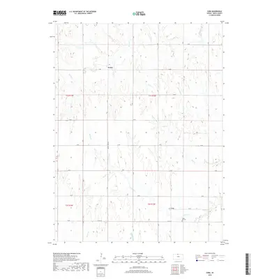
2018 Map of Cora
USGS Topo · Published 2018About this map
Womer sits atop the high ground of northern Smith County, surrounded by a complex network of prairie drainages in the early twenty-first century. The landscape is defined by the headwaters and tributaries of several major creeks, including Walnut Cr and Buffalo Cr in the north, while White Rock Cr, Wolf Cr, and Pawnee Cr carve through the central and southern reaches. The rectangular survey system is clearly visible through a rigid grid of section-line roads, such as Walnut Creek Rd and Co Rd 334, which dictate the movement of local travel across the Smith County terrain.
Find a feature on this map
30 named features on this map. Tap any name to fly to it.
Don’t see what you’re looking for? This feature index may not catch every label — zoom into the map to look around manually.
Map Details
Editions of this 2018 Cora Map
This is the sole edition of this map. No revisions or reprints were ever made.
Other maps of this area

1893 · Smith Center
USGS Topo · 1:125,000

1897 · Red Cloud
USGS Topo · 1:125,000

1940 · Red Cloud
USGS Topo · 1:62,500

1942 · Red Cloud
USGS Topo · 1:62,500

1955 · Grand Island
USGS Topo · 1:250,000

1955 · Beloit
USGS Topo · 1:250,000

1957 · Grand Island
USGS Topo · 1:250,000

1958 · Grand Island
USGS Topo · 1:250,000

1959 · Beloit
USGS Topo · 1:250,000
1973 · Cora
USGS Topo · 1:24,000