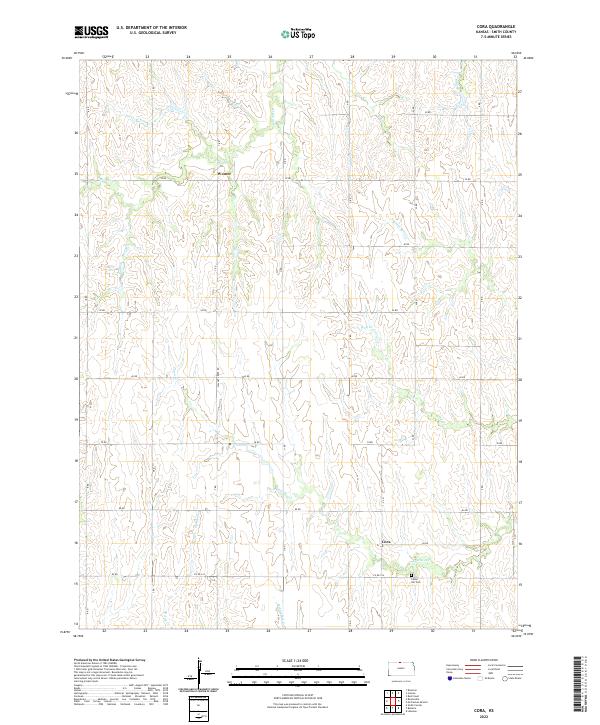
2022 Map of Cora
USGS Topo · Published 2022About this map
Cora and Womer anchor this northern Kansas landscape, where the rural sections are defined by a sophisticated network of section-line roads and winding creek drainages. The area is heavily dissected by the upper reaches of White Rock Cr and its various tributaries, including Wolf Cr and Pawnee Cr, which carve through the plains. This drainage pattern dictates the placement of local infrastructure, such as the Cedar Hill Cem located near the intersection of Co RD 334 and 85 RD. The survey illustrates the persistence of small agricultural hubs and the importance of localized water sources like Walnut Cr and Spring Cr in Smith County. For those researching family history in the region, the map provides precise locations for original homestead tracts and the township boundaries of T1S R12W and T2S R12W.
Find a feature on this map
33 named features on this map. Tap any name to fly to it.
Don’t see what you’re looking for? This feature index may not catch every label — zoom into the map to look around manually.
Map Details
Editions of this 2022 Cora Map
This is the sole edition of this map. No revisions or reprints were ever made.
Other maps of this area

1893 · Smith Center
USGS Topo · 1:125,000

1897 · Red Cloud
USGS Topo · 1:125,000

1940 · Red Cloud
USGS Topo · 1:62,500

1942 · Red Cloud
USGS Topo · 1:62,500

1955 · Grand Island
USGS Topo · 1:250,000

1955 · Beloit
USGS Topo · 1:250,000

1957 · Grand Island
USGS Topo · 1:250,000

1958 · Grand Island
USGS Topo · 1:250,000

1959 · Beloit
USGS Topo · 1:250,000
1973 · Cora
USGS Topo · 1:24,000