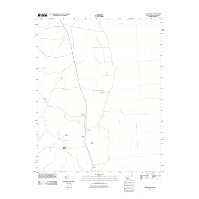
2011 Map of Corapeake
USGS Topo · Published 2011About this map
Corapeake and the neighboring settlements of Holly Grove and Parkers Fork anchor this northeastern North Carolina landscape, where the coastal plain meets the intricate hydrology of the Great Dismal Swamp area. The terrain is defined by its extensive drainage network, characterized by numerous linear features such as Railroad Ditch, West Ditch, and Sherrill Ditch that crisscross the low-lying ground.
Find a feature on this map
29 named features on this map. Tap any name to fly to it.
Don’t see what you’re looking for? This feature index may not catch every label — zoom into the map to look around manually.
Map Details
Editions of this 2011 Corapeake Map
This is the sole edition of this map. No revisions or reprints were ever made.
Other maps of this area

1906 · Beckford
USGS Topo · 1:48,000

1907 · Beckford
USGS Topo · 1:62,500

1919 · Suffolk
USGS Topo · 1:62,500

1940 · Beckford
USGS Topo · 1:62,500

1940 · Lake Drummond
USGS Topo · 1:62,500

1940 · South Mills
USGS Topo · 1:62,500

1945 · Lake Drummond
USGS Topo · 1:62,500

1952 · South Mills
USGS Topo · 1:62,500

1953 · Norfolk
USGS Topo · 1:250,000
1954 · Buckhorn
USGS Topo · 1:24,000