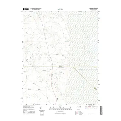
2016 Map of Corapeake
USGS Topo · Published 2016About this map
The Great Dismal Swamp dominates the eastern landscape of this 2016 survey, a sprawling wetland complex defined by a geometric network of drainage channels such as Corapeake Ditch and the Railroad Ditch. The border between North Carolina and Virginia bisects the sheet, separating the farming communities of Gates County from the northern reaches of the swamp. Settlement is concentrated along the north-south corridor of Route 32, where the village of Corapeake serves as a central hub.
Find a feature on this map
52 named features on this map. Tap any name to fly to it.
Don’t see what you’re looking for? This feature index may not catch every label — zoom into the map to look around manually.
Map Details
Editions of this 2016 Corapeake Map
This is the sole edition of this map. No revisions or reprints were ever made.
Other maps of this area

1906 · Beckford
USGS Topo · 1:48,000

1907 · Beckford
USGS Topo · 1:62,500

1919 · Suffolk
USGS Topo · 1:62,500

1940 · Beckford
USGS Topo · 1:62,500

1940 · Lake Drummond
USGS Topo · 1:62,500

1940 · South Mills
USGS Topo · 1:62,500

1945 · Lake Drummond
USGS Topo · 1:62,500

1952 · South Mills
USGS Topo · 1:62,500

1953 · Norfolk
USGS Topo · 1:250,000
1954 · Buckhorn
USGS Topo · 1:24,000