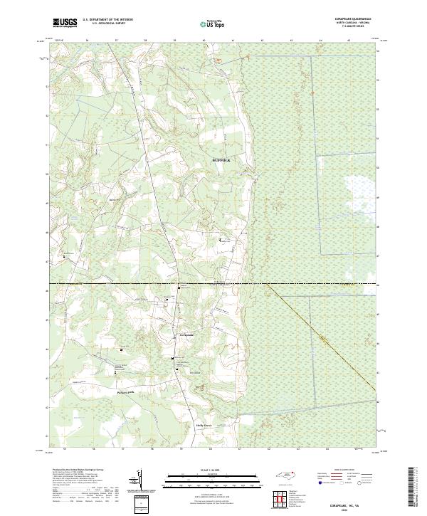
2022 Map of Corapeake
USGS Topo · Published 2022About this map
The Great Dismal Swamp dominates the eastern landscape of this borderland, where the Virginia-North Carolina state line bisects a network of drainage canals and wetlands. The intricate water management system is defined by features like the Railroad Ditch, Interior Ditch, and Corapeake Ditch, which dictate the local topography and agricultural patterns. To the west, the ground rises toward Baines Hill and the settlement of Corapeake, serving as a hub for local spiritual and community life. Genealogists will find a high density of family and church landmarks, including the Zion Tabernacle Baptist Church, Parker's United Methodist Church, and smaller family plots like the Winslow Cem and Riddick Cem. The map illustrates a landscape where small communities like Parkers Fork and Holly Grove have developed along the margins of the Hall Pocosin and Adams Swamp, maintaining a distinct rural character shaped by the surrounding hydrology.
Find a feature on this map
56 named features on this map. Tap any name to fly to it.
Don’t see what you’re looking for? This feature index may not catch every label — zoom into the map to look around manually.
Map Details
Editions of this 2022 Corapeake Map
This is the sole edition of this map. No revisions or reprints were ever made.
Other maps of this area

1906 · Beckford
USGS Topo · 1:48,000

1907 · Beckford
USGS Topo · 1:62,500

1919 · Suffolk
USGS Topo · 1:62,500

1940 · Beckford
USGS Topo · 1:62,500

1940 · Lake Drummond
USGS Topo · 1:62,500

1940 · South Mills
USGS Topo · 1:62,500

1945 · Lake Drummond
USGS Topo · 1:62,500

1952 · South Mills
USGS Topo · 1:62,500

1953 · Norfolk
USGS Topo · 1:250,000
1954 · Buckhorn
USGS Topo · 1:24,000