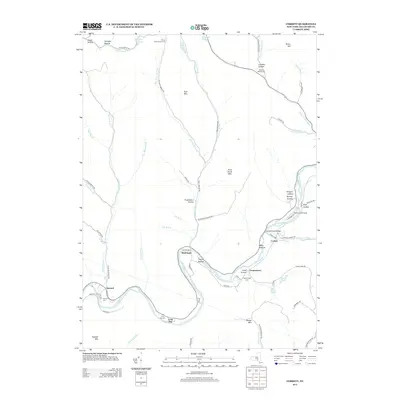
2013 Map of Corbett
USGS Topo · Published 2013About this map
The East Br Delaware River meanders through the heart of this Delaware County landscape, connecting a string of small riverside settlements including Harvard, Shinhopple, and Long Flat. The valley's settlement patterns are closely tied to the water, with narrow roads like River Rd and Shinhopple Brook Rd tracing the paths of numerous tributary brooks. Small communities such as Corbett and Gregorytown serve as focal points in the eastern half of the map, while the Downsville Airport and the Corbett Road Bridge indicate the modern infrastructure supporting this rural area. For genealogists, the map is particularly useful for locating family plots, noting the distribution of local burial grounds such as the Harvard Cem, Long Flat Cem, and Gregorytown Cem. The surrounding terrain is defined by prominent peaks and hollows, including Baxter Mtn, Fork Mtn, and Lindsley Hollow, which have long shaped the region's agricultural and residential boundaries.
Find a feature on this map
78 named features on this map. Tap any name to fly to it.
Don’t see what you’re looking for? This feature index may not catch every label — zoom into the map to look around manually.
Map Details
Editions of this 2013 Corbett Map
This is the sole edition of this map. No revisions or reprints were ever made.
Other maps of this area

1920 · Long Eddy
USGS Topo · 1:62,500

1921 · Long Eddy
USGS Topo · 1:48,000

1921 · Livingston Manor
USGS Topo · 1:62,500

1922 · Andes
USGS Topo · 1:62,500

1923 · Long Eddy
USGS Topo · 1:62,500

1923 · Walton
USGS Topo · 1:48,000

1923 · Livingston Manor
USGS Topo · 1:62,500

1924 · Andes
USGS Topo · 1:62,500

1925 · Walton
USGS Topo · 1:62,500

1943 · Honesdale
USGS Topo · 1:125,000