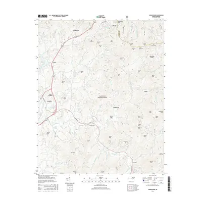
2016 Map of Corbin Knob
USGS Topo · Published 2016About this map
Franklin and the Little Tennessee River anchor this survey of the high mountain terrain where the Cowee Mountains meet the vast Nantahala National Forest. The landscape is defined by the winding course of the Cullasaja River, which cuts through the southern half of the map, passing the community of Cullasaja and the mineral-named settlement of Gneiss. Small crossroads and localities like Higdonville, Ellijay, and Brendletown are tucked into the valleys between prominent peaks such as Corundum Hill and Onion Mtn. This area reflects a long-standing rural Appalachian character, where local landmarks like the Angel Cem and Berry Mill serve as physical touchstones for the families who have inhabited these coves for generations. Transport is dictated by the steep topography, with Sylva Rd and Highlands Rd following the natural breaks in the ridges and the paths of historical waterways like Rabbit Cr.
Find a feature on this map
99 named features on this map. Tap any name to fly to it.
Don’t see what you’re looking for? This feature index may not catch every label — zoom into the map to look around manually.
Map Details
Editions of this 2016 Corbin Knob Map
This is the sole edition of this map. No revisions or reprints were ever made.
Other maps of this area

1891 · Cowee
USGS Topo · 1:125,000

1897 · Cowee
USGS Topo · 1:125,000

1907 · Cowee
USGS Topo · 1:125,000

1933 · Bryson
USGS Topo · 1:62,500

1935 · Franklin
USGS Topo · 1:24,000

1935 · Prentiss
USGS Topo · 1:24,000

1935 · Cullowhee
USGS Topo · 1:24,000

1935 · Scaly
USGS Topo · 1:24,000

1935 · Glenville
USGS Topo · 1:24,000

1935 · Corbin Knob
USGS Topo · 1:24,000