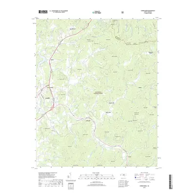
2019 Map of Corbin Knob
USGS Topo · Published 2019About this map
The Little Tennessee River and Cullasaja River shape this portion of Macon County, where the valley floor transitions into the heights of the Cowee Mountains. High-elevation landmarks such as Corbin Knob and Onion Mtn rise above a landscape defined by small mountain settlements like Gneiss, Higdonville, and Brendletown. The map documents the rural infrastructure of the early 21st century, showing how Sylva Rd and Highlands Rd navigate the steep terrain between Franklin and the surrounding peaks.
Find a feature on this map
100 named features on this map. Tap any name to fly to it.
Don’t see what you’re looking for? This feature index may not catch every label — zoom into the map to look around manually.
Map Details
Editions of this 2019 Corbin Knob Map
This is the sole edition of this map. No revisions or reprints were ever made.
Other maps of this area

1891 · Cowee
USGS Topo · 1:125,000

1897 · Cowee
USGS Topo · 1:125,000

1907 · Cowee
USGS Topo · 1:125,000

1933 · Bryson
USGS Topo · 1:62,500

1935 · Franklin
USGS Topo · 1:24,000

1935 · Prentiss
USGS Topo · 1:24,000

1935 · Cullowhee
USGS Topo · 1:24,000

1935 · Scaly
USGS Topo · 1:24,000

1935 · Glenville
USGS Topo · 1:24,000

1935 · Corbin Knob
USGS Topo · 1:24,000