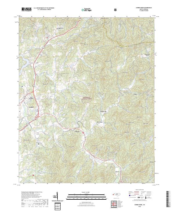
2022 Map of Corbin Knob
USGS Topo · Published 2022About this map
Cullasaja and Gneiss sit along the winding Cullasaja River, highlighting a landscape where settlement follows the narrow corridors carved through the Nantahala National Forest. This 2022 survey documents the contemporary geography of eastern Macon County, where the Cowee Mountains and features like Corundum Hill define the terrain. The map records several small communities such as Higdonville and Dean, alongside the industrial and social history represented by Berry Mill and the Angel Cem. To the northwest, the Little Tennessee River passes through Franklin and East Franklin, marking the transition from the high ridges of Corbin Knob and Onion Mtn down toward the valley floor. The placement of Watauga Vista Lake and the various branches of Rabbit Cr show the enduring importance of water sources in this mountain environment.
Find a feature on this map
104 named features on this map. Tap any name to fly to it.
Don’t see what you’re looking for? This feature index may not catch every label — zoom into the map to look around manually.
Map Details
Editions of this 2022 Corbin Knob Map
This is the sole edition of this map. No revisions or reprints were ever made.
Other maps of this area

1891 · Cowee
USGS Topo · 1:125,000

1897 · Cowee
USGS Topo · 1:125,000

1907 · Cowee
USGS Topo · 1:125,000

1933 · Bryson
USGS Topo · 1:62,500

1935 · Franklin
USGS Topo · 1:24,000

1935 · Prentiss
USGS Topo · 1:24,000

1935 · Cullowhee
USGS Topo · 1:24,000

1935 · Scaly
USGS Topo · 1:24,000

1935 · Glenville
USGS Topo · 1:24,000

1935 · Corbin Knob
USGS Topo · 1:24,000