
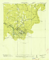
1935 Map of Corbin Knob
USGS Topo · Published 1935About this map
Franklin and the adjacent reaches of the Little Tennessee River define the western edge of this 1935 survey, which details the rural landscape of Macon County during the Tennessee Valley Authority’s early infrastructure projects. The river is notably harnessed at Lake Emory by the Porters Bend Dam, with transmission lines threading through the valley to serve local growth. The geography is characterized by numerous watercourses like the Cullasaja River and Ellijay Creek, where small settlements and community landmarks such as Higdonville and Gneiss sit among the foothills.
Find a feature on this map
89 named features on this map. Tap any name to fly to it.
Don’t see what you’re looking for? This feature index may not catch every label — zoom into the map to look around manually.
Map Details
Editions of this 1935 Corbin Knob Map
This is the sole edition of this map. No revisions or reprints were ever made.
Other maps of this area

1891 · Cowee
USGS Topo · 1:125,000

1897 · Cowee
USGS Topo · 1:125,000

1907 · Cowee
USGS Topo · 1:125,000

1933 · Bryson
USGS Topo · 1:62,500

1935 · Franklin
USGS Topo · 1:24,000

1935 · Prentiss
USGS Topo · 1:24,000

1935 · Cullowhee
USGS Topo · 1:24,000

1935 · Scaly
USGS Topo · 1:24,000

1935 · Glenville
USGS Topo · 1:24,000
1935 · Highlands
USGS Topo · 1:24,000