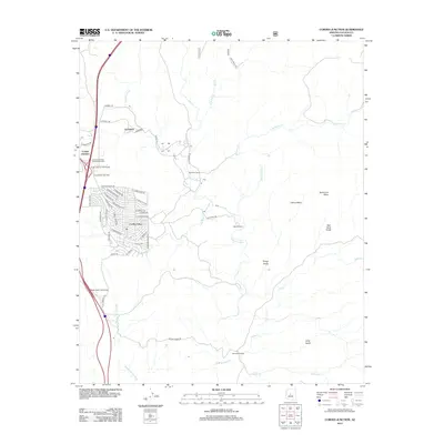
2012 Map of Cordes Junction
USGS Topo · Published 2012About this map
Arcosanti, the experimental architectural project, sits on the edge of the Agua Fria River canyon, providing a distinct contrast to the more conventional residential expansion of Cordes Lakes to the south. This 2012 survey captures the high-desert landscape as it transitions from historic ranching properties to a modern transportation and residential hub. The intricate street network of Cordes Lakes, with names like E Stagecoach Trl and E Conestoga Dr, reflects a suburban pattern built into the natural drainage systems of Big Bug Cr.
Find a feature on this map
57 named features on this map. Tap any name to fly to it.
Don’t see what you’re looking for? This feature index may not catch every label — zoom into the map to look around manually.
Map Details
Editions of this 2012 Cordes Junction Map
This is the sole edition of this map. No revisions or reprints were ever made.
Other maps of this area
1887 · Verde
USGS Topo · 1:250,000
1887 · Prescott
USGS Topo · 1:250,000
1892 · Verde
USGS Topo · 1:250,000
1892 · Prescott
USGS Topo · 1:250,000
1903 · Bradshaw Mountains
USGS Topo · 1:125,000
1929 · Turret Peak
USGS Topo · 1:125,000
1933 · Turret Peak
USGS Topo · 1:125,000
1947 · Bumblebee
USGS Topo · 1:62,500
1947 · Mayer
USGS Topo · 1:62,500
1948 · Bumblebee
USGS Topo · 1:63,360