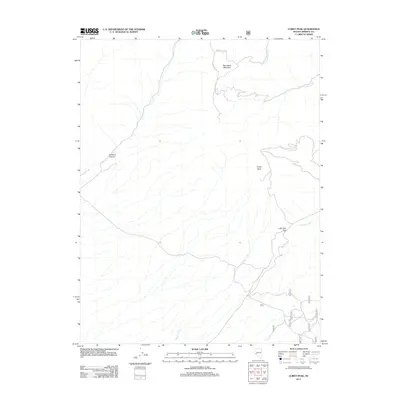
2011 Map of Corey Peak
USGS Topo · Published 2011About this map
Corey Peak and Big Indian Mountain dominate this high-elevation corner of Nevada, where the drainage networks of Corey Creek and Squaw Creek cut through the arid landscape. The 2011 survey captures the area's transition into the modern era, emphasizing a complex network of forest and mountain roads such as Lucky Boy Pass Rd and N Fork Cat Cr Rd that navigate the steep terrain. This map highlights the critical importance of these corridors in Mineral County, providing access through landmarks like Lucky Boy Pass. The detailed hydrography, including South Fork Cat Creek and Garfield Creek, illustrates the seasonal water flow patterns characteristic of the eastern Sierra Nevada foothills. Smaller geographic features like Baldwin Canyon and various numbered forest routes provide specific points of interest for those studying the remote infrastructure of this high-desert environment.
Find a feature on this map
18 named features on this map. Tap any name to fly to it.
Don’t see what you’re looking for? This feature index may not catch every label — zoom into the map to look around manually.
Map Details
Editions of this 2011 Corey Peak Map
This is the sole edition of this map. No revisions or reprints were ever made.
Other maps of this area

1909 · Hawthorne
USGS Topo · 1:250,000

1911 · Hawthorne
USGS Topo · 1:250,000

1915 · Hawthorne
USGS Topo · 1:250,000

1948 · Walker Lake
USGS Topo · 1:250,000

1955 · Powell Mtn
USGS Topo · 1:62,500

1955 · Hawthorne
USGS Topo · 1:62,500

1956 · Mt. Grant
USGS Topo · 1:62,500

1956 · Aurora
USGS Topo · 1:62,500

1957 · Walker Lake
USGS Topo · 1:250,000

1962 · Walker Lake
USGS Topo · 1:250,000