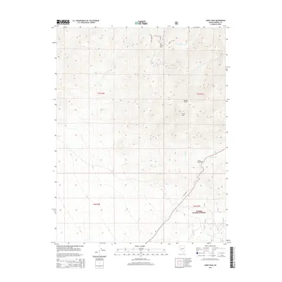
2014 Map of Corey Peak
USGS Topo · Published 2014About this map
Corey Peak and Big Indian Mtn anchor this high-elevation terrain within the Wassuk Range of Mineral County. This portion of the Toiyabe National Forest is defined by a series of steep drainages, including Squaw Cr, Corey Cr, and Garfield Cr, which cut through the high desert landscape. The presence of Lucky Boy Pass suggests a vital historical transit point through the range, as indicated by the eponymous Lucky Boy Rd that winds toward the summit. The complex topography shown here is characteristic of Nevada's Basin and Range province, where narrow, high-altitude ridges are separated by deep canyons like the N Fork Cottonwood Canyon.
Find a feature on this map
16 named features on this map. Tap any name to fly to it.
Don’t see what you’re looking for? This feature index may not catch every label — zoom into the map to look around manually.
Map Details
Editions of this 2014 Corey Peak Map
This is the sole edition of this map. No revisions or reprints were ever made.
Other maps of this area

1909 · Hawthorne
USGS Topo · 1:250,000

1911 · Hawthorne
USGS Topo · 1:250,000

1915 · Hawthorne
USGS Topo · 1:250,000

1948 · Walker Lake
USGS Topo · 1:250,000

1955 · Powell Mtn
USGS Topo · 1:62,500

1955 · Hawthorne
USGS Topo · 1:62,500

1956 · Mt. Grant
USGS Topo · 1:62,500

1956 · Aurora
USGS Topo · 1:62,500

1957 · Walker Lake
USGS Topo · 1:250,000

1962 · Walker Lake
USGS Topo · 1:250,000