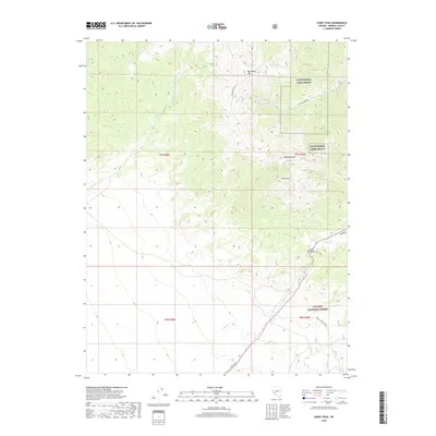
2018 Map of Corey Peak
USGS Topo · Published 2018About this map
Cory Peak and the Wassuk Range dominate this Mineral County landscape, where the high desert terrain meets specialized military infrastructure. The northeastern portion of the sheet is occupied by the Hawthorne Army Depot, a significant federal facility that defines the local land use alongside the Toiyabe National Forest. This intersection of protected forest lands and military reservation creates a unique geographical footprint, split by the winding path of Lucky Boy Pass Rd.
Find a feature on this map
17 named features on this map. Tap any name to fly to it.
Don’t see what you’re looking for? This feature index may not catch every label — zoom into the map to look around manually.
Map Details
Editions of this 2018 Corey Peak Map
This is the sole edition of this map. No revisions or reprints were ever made.
Other maps of this area

1909 · Hawthorne
USGS Topo · 1:250,000

1911 · Hawthorne
USGS Topo · 1:250,000

1915 · Hawthorne
USGS Topo · 1:250,000

1948 · Walker Lake
USGS Topo · 1:250,000

1955 · Powell Mtn
USGS Topo · 1:62,500

1955 · Hawthorne
USGS Topo · 1:62,500

1956 · Mt. Grant
USGS Topo · 1:62,500

1956 · Aurora
USGS Topo · 1:62,500

1957 · Walker Lake
USGS Topo · 1:250,000

1962 · Walker Lake
USGS Topo · 1:250,000