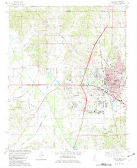
1982 Map of Corinth
USGS Topo · Published 1983About this map
Corinth serves as a major regional crossroads in the early 1980s, defined by the intersection of the Southern and Illinois Central Gulf Railroad lines. The urban landscape is densely detailed, featuring the Courthouse, City Hall, and the expansive National Cem. This period shows the city expanding toward North Corinth and Ruslor Junction, with essential infrastructure like Magnolia Hospital and the Voc-Tech Sch supporting the growing population.
Find a feature on this map
58 named features on this map. Tap any name to fly to it.
Don’t see what you’re looking for? This feature index may not catch every label — zoom into the map to look around manually.
Map Details
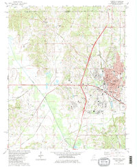
Editions of this 1982 Corinth Map
2 editions found
Other maps of this area

1935 · Glens
USGS Topo · 1:24,000

1936 · Kendrick
USGS Topo · 1:24,000

1936 · Michie
USGS Topo · 1:24,000

1949 · Michie
USGS Topo · 1:24,000

1950 · Corinth
USGS Topo · 1:62,500

1950 · Kendrick
USGS Topo · 1:24,000

1950 · Glens
USGS Topo · 1:24,000

1951 · Chewalla
USGS Topo · 1:24,000

1951 · Guys
USGS Topo · 1:24,000
1952 · Michie
USGS Topo · 1:24,000