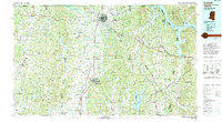
1994 Map of Corinth
USGS Topo · Published 1994About this map
The crossroads city of Corinth anchors this 1994 topographic study of Northeast Mississippi, where the Southern Railway and Illinois Central Gulf Railroad corridors intersect. The landscape is defined by the massive engineering of the Tennessee-Tombigbee Waterway, which cuts through the Divide Ridge to connect the Tennessee River drainage with Bay Springs Lake to the south. To the west, the Holly Springs National Forest protects the headwaters of the Tippah River and Little Hatchie River.
Find a feature on this map
139 named features on this map. Tap any name to fly to it.
Don’t see what you’re looking for? This feature index may not catch every label — zoom into the map to look around manually.
Map Details
Editions of this 1994 Corinth Map
This is the sole edition of this map. No revisions or reprints were ever made.
Other maps of this area

1905 · Waynesboro
USGS Topo · 1:125,000

1911 · Iuka
USGS Topo · 1:48,000

1914 · Iuka
USGS Topo · 1:62,500

1921 · Booneville
USGS Topo · 1:48,000

1921 · Tupelo
USGS Topo · 1:48,000

1922 · Booneville
USGS Topo · 1:62,500

1923 · Tupelo
USGS Topo · 1:62,500

1924 · Gravelly Springs
USGS Topo · 1:48,000

1925 · Barton
USGS Topo · 1:62,500

1926 · Barton
USGS Topo · 1:48,000