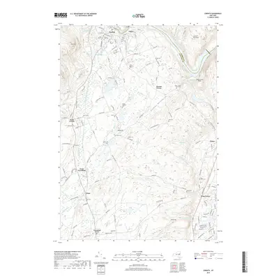
2019 Map of Corinth
USGS Topo · Published 2019About this map
Corinth and the industrial hamlet of Palmer sit at a bend in the Hudson River where the Warren Co and Saratoga Co borders meet. This landscape is defined by its numerous family burial grounds and small settlements scattered through the foothills of the Palmertown Range and the Luzerne Mountains. To the south, the terrain opens into a complex network of wetlands and drainage basins including Fuller Swamp and the headwaters of the Snook Kill. This 2019 survey documents the enduring rural character of the region, from the upland drainage of Heath Brook to the lower elevation hamlets like Greenfield Center and North Greenfield. Researchers will find a high density of genealogical landmarks, such as the Nathan Carpenter Cem and John Eggleston Cem, which reflect the generations of residents who established these small communities along the Kayaderosseras Cr and its tributaries.
Find a feature on this map
144 named features on this map. Tap any name to fly to it.
Don’t see what you’re looking for? This feature index may not catch every label — zoom into the map to look around manually.
Map Details
Editions of this 2019 Corinth Map
This is the sole edition of this map. No revisions or reprints were ever made.
Other maps of this area

1895 · Glens Falls
USGS Topo · 1:62,500

1897 · Glens Falls
USGS Topo · 1:62,500

1900 · Schuylerville
USGS Topo · 1:62,500

1902 · Saratoga
USGS Topo · 1:62,500

1903 · Luzerne
USGS Topo · 1:62,500
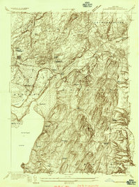
1934 · Quaker Springs
USGS Topo · 1:24,000

1934 · Saratoga Springs
USGS Topo · 1:24,000

1935 · Gansevoort
USGS Topo · 1:24,000

1935 · Middle Grove
USGS Topo · 1:24,000

1935 · Corinth
USGS Topo · 1:24,000