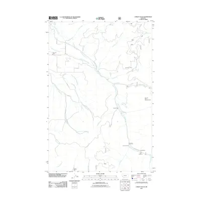
2011 Map of Corley Gulch
USGS Topo · Published 2011About this map
La Fontaine and the surrounding drainage of the Burnt Fork Bitterroot River define this corner of Ravalli County, characterized by a complex network of mountain creeks and canyons. The landscape is marked by resource extraction and forest recreation, including the SE NW Section 7 Mine and the NW SW Section 9 Mine. Access to the higher elevations, such as Whe-lha-kleh-tseen Mountain, is traced through local routes like McIntyre Rd and the Pack Trl. The presence of the Stevensville Rural Fire Sta and Upper Burnt Fork School Rd indicates the proximity of established rural services near the valley floor. To the southeast, the topography shifts toward recreational use at the Gold Creek Trailhead and Cutoff Gulch Campground, providing a look at how this Bitterroot mountain terrain is navigated for both industry and leisure.
Find a feature on this map
40 named features on this map. Tap any name to fly to it.
Don’t see what you’re looking for? This feature index may not catch every label — zoom into the map to look around manually.
Map Details
Editions of this 2011 Corley Gulch Map
This is the sole edition of this map. No revisions or reprints were ever made.
Other maps of this area

1901 · Hamilton
USGS Topo · 1:125,000

1903 · Bonner
USGS Topo · 1:125,000

1909 · Sapphire
USGS Topo · 1:125,000

1912 · Missoula
USGS Topo · 1:125,000

1947 · Butte
USGS Topo · 1:250,000

1956 · Hamilton
USGS Topo · 1:250,000

1958 · Butte
USGS Topo · 1:250,000

1959 · Hamilton
USGS Topo · 1:250,000

1959 · Cleveland Mountain
USGS Topo · 1:62,500

1960 · Butte
USGS Topo · 1:250,000