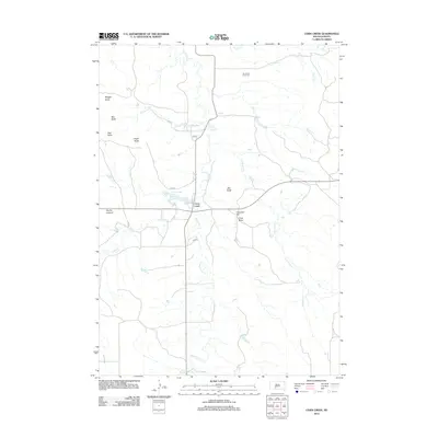
2012 Map of Corn Creek
USGS Topo · Published 2012About this map
Corn Creek sits at the intersection of local routes and natural waterways in Mellette County, where the plains are punctuated by distinct geological formations. The landscape is defined by its series of named rises, including Eagle Butte, Teat Butte, and Coyote Lookout, which served as navigational markers for generations. Water management and drainage patterns are visible through the course of Black Pipe Cr and the presence of Corn Creek Lake. Local heritage and genealogy are anchored by the Stands for Them Cem and Cemetery Hill, situated near the central settlement area. The map illustrates a contemporary rural infrastructure where ancient topography and modern roads like San 63 coexist, with several tributaries such as Owl Cr and Church Cr carving through the high plains terrain.
Find a feature on this map
20 named features on this map. Tap any name to fly to it.
Don’t see what you’re looking for? This feature index may not catch every label — zoom into the map to look around manually.
Map Details
Editions of this 2012 Corn Creek Map
This is the sole edition of this map. No revisions or reprints were ever made.
Other maps of this area

1951 · Cedar Butte NW
USGS Topo · 1:24,000

1951 · Cedar Butte NE
USGS Topo · 1:24,000

1951 · Pass Creek NE
USGS Topo · 1:24,000

1955 · Martin
USGS Topo · 1:250,000

1958 · Martin
USGS Topo · 1:250,000

1969 · Norris
USGS Topo · 1:24,000

1969 · Parmelee NE
USGS Topo · 1:24,000

1980 · Kadoka
USGS Topo · 1:100,000

1981 · Cedar Butte
USGS Topo · 1:25,000

1981 · Long Valley
USGS Topo · 1:25,000
Featured Places
- Corn Creek Segment, SD
- Corn Creek, Corn Creek Segment
- Wanblee, SD
- Black Pipe Segment, SD
- Jackson County, SD