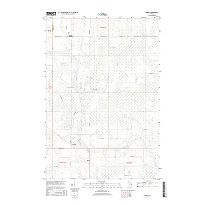
2017 Map of Cornell
USGS Topo · Published 2017About this map
Escanaba River dominates the central corridor of this Delta County landscape, winding south past the small community of Cornell. The settlement pattern reflects the area's rural and agricultural roots, with roads like Potato Ln, Orchard 24th Ln, and Farmfield Rd hinting at the local land use. In the northern reaches, the community of Saint Nicholas is marked by the Saint Nicholas Cem, a key landmark for genealogical research in this portion of the Upper Peninsula. To the west, the border with Marquette County is defined near the waters of Squaw Cr. The terrain is intricately carved by numerous tributaries including Hunters Brook, Indian Cr, and the W Br Days River. A notable natural feature, Rose Falls (East), is located along the river north of Cornell, providing a point of interest for those tracking historical water features and local landmarks like Salva.
Find a feature on this map
50 named features on this map. Tap any name to fly to it.
Don’t see what you’re looking for? This feature index may not catch every label — zoom into the map to look around manually.
Map Details
Editions of this 2017 Cornell Map
This is the sole edition of this map. No revisions or reprints were ever made.
Other maps of this area

1932 · Gladstone NE
USGS Topo · 1:31,680

1932 · Rock SW
USGS Topo · 1:31,680

1932 · Gladstone SE
USGS Topo · 1:31,680

1932 · Rock SE
USGS Topo · 1:31,680

1932 · Whitney NE
USGS Topo · 1:31,680

1932 · Whitney SE
USGS Topo · 1:31,680

1932 · Gladstone SW
USGS Topo · 1:31,680

1932 · Helena
USGS Topo · 1:31,680

1932 · Gladstone NW
USGS Topo · 1:31,680

1950 · Gladstone NW
USGS Topo · 1:31,680