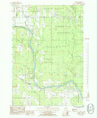
1985 Map of Cornell
USGS Topo · Published 1985About this map
The Escanaba River anchors this mid-1980s landscape in Delta County, where timber and transport legacy is visible in the expansive Escanaba River State Forest. The community of Cornell sits near the river's bend, marked by a Gaging Station and Substation, reflecting the management of these northern waters. Evidence of the region’s industrial past and transit networks is prominent, with the Lake Superior and Ishpeming RR cutting through the southern section while an Old Railroad Grade remains visible near St Nicholas to the north.
Find a feature on this map
25 named features on this map. Tap any name to fly to it.
Don’t see what you’re looking for? This feature index may not catch every label — zoom into the map to look around manually.
Map Details
Editions of this 1985 Cornell Map
This is the sole edition of this map. No revisions or reprints were ever made.
Other maps of this area

1932 · Gladstone NE
USGS Topo · 1:31,680

1932 · Rock SW
USGS Topo · 1:31,680

1932 · Gladstone SE
USGS Topo · 1:31,680

1932 · Rock SE
USGS Topo · 1:31,680

1932 · Whitney NE
USGS Topo · 1:31,680

1932 · Whitney SE
USGS Topo · 1:31,680

1932 · Gladstone SW
USGS Topo · 1:31,680

1932 · Helena
USGS Topo · 1:31,680

1932 · Gladstone NW
USGS Topo · 1:31,680

1950 · Gladstone NW
USGS Topo · 1:31,680