
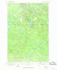
1958 Map of Corner Lake
USGS Topo · Published 1959About this map
Hiawatha National Forest dominates this landscape in Michigan's Upper Peninsula, revealing a remote wilderness defined by timber history and numerous glacial lakes. The small settlement of Steuben and the Steuben Landing Field serve as central points in a region otherwise marked by forestry and seasonal camps, such as Camp Twenty-six and Camp Forty-one. The network of water bodies, including Big Island Lake and Squaw Lake, highlights the importance of the land for both natural resources and recreation, further evidenced by the Petoskey Hunting Club. A Railroad Grade cutting through the northern section and several Gravel Pits suggest the industrial underpinnings of this woodland. Fire prevention infrastructure is visible through strategically placed towers like the Tie Hill Lookout Tower and Waco Lookout Tower, which monitored the vast expanses of Munising and Au Train townships during the mid-century.
Find a feature on this map
167 named features on this map. Tap any name to fly to it.
Don’t see what you’re looking for? This feature index may not catch every label — zoom into the map to look around manually.
Map Details
Editions of this 1958 Corner Lake Map
2 editions found
Other maps of this area

1931 · Steuben SW
USGS Topo · 1:31,680

1931 · Cooks NW
USGS Topo · 1:31,680

1931 · Shingleton SW
USGS Topo · 1:31,680

1931 · Steuben NW
USGS Topo · 1:31,680

1931 · Skeels Lake NE
USGS Topo · 1:31,680

1931 · Munising SE
USGS Topo · 1:31,680

1932 · Rapid River NE
USGS Topo · 1:31,680

1932 · Garden NW and SW
USGS Topo · 1:31,680

1932 · Skeels Lake SE
USGS Topo · 1:31,680

1932 · Trenary SE
USGS Topo · 1:31,680