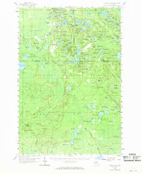
1958 Map of Corner Lake
USGS Topo · Published 1968About this map
The Hiawatha National Forest dominates this mid-century landscape across the intersection of Alger, Delta, and Schoolcraft Counties. A dense network of glacial lakes defines the northern terrain, including Turtle Lake, Cucumber Lake, and Big Island Lake, while an Old Railroad Grade suggests the legacy of logging operations that once moved through these woods. Small pockets of human activity appear in the remote forest, such as Steuben and the Petoskey Hunting Club, providing a glimpse into the seasonal and permanent settlements of the Michigan Upper Peninsula before modern infrastructure expanded. The presence of the Waco Lookout Tower and another Lookout Tower near Ganamush Lake highlights the era's reliance on manned fire observation in these heavily timbered lands. From the Landing Field at Steuben to the isolated Gravel Pits, the map records a wilderness being utilized for timber, recreation, and natural resource management.
Find a feature on this map
161 named features on this map. Tap any name to fly to it.
Don’t see what you’re looking for? This feature index may not catch every label — zoom into the map to look around manually.
Map Details
Editions of this 1958 Corner Lake Map
2 editions found

Other maps of this area

1931 · Steuben SW
USGS Topo · 1:31,680

1931 · Cooks NW
USGS Topo · 1:31,680

1931 · Shingleton SW
USGS Topo · 1:31,680

1931 · Steuben NW
USGS Topo · 1:31,680

1931 · Skeels Lake NE
USGS Topo · 1:31,680

1931 · Munising SE
USGS Topo · 1:31,680

1932 · Rapid River NE
USGS Topo · 1:31,680

1932 · Garden NW and SW
USGS Topo · 1:31,680

1932 · Skeels Lake SE
USGS Topo · 1:31,680

1932 · Trenary SE
USGS Topo · 1:31,680