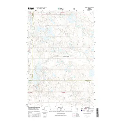
2014 Map of Corner Lake
USGS Topo · Published 2014About this map
The Hiawatha National Forest defines the character of this Upper Peninsula landscape, spanning a region where Delta, Alger, and Schoolcraft counties converge. The geography is characterized by an exceptional density of glacial lakes, ranging from larger bodies like Big Island Lake and Petes Lake to more secluded waters such as Klondike Lake and Green Bass Lake. This 2014 survey documents a wilderness environment shaped by the Little Indian River and its various tributaries, including Deltas Run and Grassy Creek. The map provides a precise look at the township and range lines that grid this densely forested area, showing the proximity of landmarks like Moccasin Lake and Townline Lake near the county boundaries. It serves as a detailed record of the natural hydrology and forest management zones in this part of Michigan just south of the Lake Superior watershed.
Find a feature on this map
71 named features on this map. Tap any name to fly to it.
Don’t see what you’re looking for? This feature index may not catch every label — zoom into the map to look around manually.
Map Details
Editions of this 2014 Corner Lake Map
This is the sole edition of this map. No revisions or reprints were ever made.
Other maps of this area

1931 · Steuben SW
USGS Topo · 1:31,680

1931 · Shingleton SW
USGS Topo · 1:31,680

1931 · Steuben NW
USGS Topo · 1:31,680

1931 · Skeels Lake NE
USGS Topo · 1:31,680

1931 · Munising SE
USGS Topo · 1:31,680

1932 · Skeels Lake SE
USGS Topo · 1:31,680

1932 · Skeels Lake NW and SW
USGS Topo · 1:31,680

1958 · Corner Lake
USGS Topo · 1:62,500

1958 · Munising
USGS Topo · 1:62,500

1958 · Shingleton
USGS Topo · 1:62,500