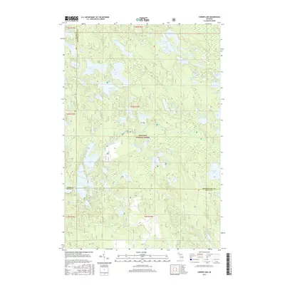
2017 Map of Corner Lake
USGS Topo · Published 2017About this map
The Hiawatha National Forest dominates this northern Michigan landscape, where the boundaries of Delta, Alger, and Schoolcraft counties meet. This interior region is characterized by a dense network of inland water bodies, ranging from the expansive Big Island Lake and Townline Lake in the north to the isolated Norway Lake and Forty Pond in the south. The absence of major settlements suggests a territory dedicated to recreation and conservation within the Upper Peninsula's forested tracts. Small, descriptively named features like Coattail Lake, Peewee Lake, and Spud Lake are scattered throughout the glacial terrain, providing a look at the wilderness character of the area in the early twenty-first century. This topographical detail is essential for understanding the distribution of water resources and forest access within these protected federal lands, including the areas surrounding Petes Lake and Herman Lake.
Find a feature on this map
74 named features on this map. Tap any name to fly to it.
Don’t see what you’re looking for? This feature index may not catch every label — zoom into the map to look around manually.
Map Details
Editions of this 2017 Corner Lake Map
This is the sole edition of this map. No revisions or reprints were ever made.
Other maps of this area

1931 · Steuben SW
USGS Topo · 1:31,680

1931 · Shingleton SW
USGS Topo · 1:31,680

1931 · Steuben NW
USGS Topo · 1:31,680

1931 · Skeels Lake NE
USGS Topo · 1:31,680

1931 · Munising SE
USGS Topo · 1:31,680

1932 · Skeels Lake SE
USGS Topo · 1:31,680

1932 · Skeels Lake NW and SW
USGS Topo · 1:31,680

1958 · Corner Lake
USGS Topo · 1:62,500

1958 · Munising
USGS Topo · 1:62,500

1958 · Shingleton
USGS Topo · 1:62,500