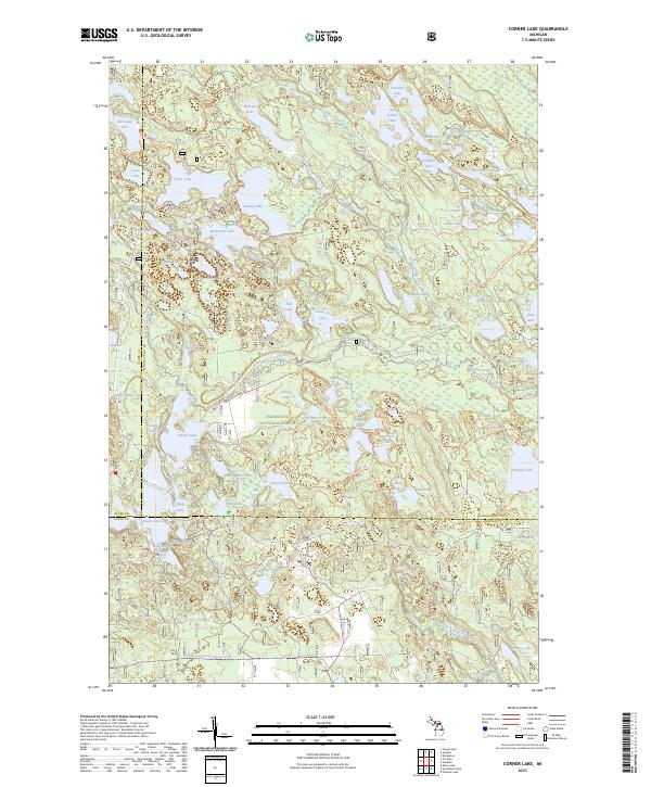
2023 Map of Corner Lake
USGS Topo · Published 2023About this map
Big Island Lake Wilderness and the Hiawatha National Forest dominate this landscape of the Upper Peninsula, situated at the intersection of Schoolcraft, Alger, and Delta counties. The terrain is defined by a dense concentration of glacial kettle lakes and wetlands, including Petes Lake, Straits Lake, and McKeever Lake. The map illustrates a complex network of modern recreational infrastructure woven through the timberlands, notably the Bruno's Run Trl and Pine Marten Run Trl.
Find a feature on this map
76 named features on this map. Tap any name to fly to it.
Don’t see what you’re looking for? This feature index may not catch every label — zoom into the map to look around manually.
Map Details
Editions of this 2023 Corner Lake Map
This is the sole edition of this map. No revisions or reprints were ever made.
Other maps of this area

1931 · Steuben SW
USGS Topo · 1:31,680

1931 · Shingleton SW
USGS Topo · 1:31,680

1931 · Steuben NW
USGS Topo · 1:31,680

1931 · Skeels Lake NE
USGS Topo · 1:31,680

1931 · Munising SE
USGS Topo · 1:31,680

1932 · Skeels Lake SE
USGS Topo · 1:31,680

1932 · Skeels Lake NW and SW
USGS Topo · 1:31,680

1958 · Corner Lake
USGS Topo · 1:62,500

1958 · Munising
USGS Topo · 1:62,500

1958 · Shingleton
USGS Topo · 1:62,500